Geospatial Lab
Details
Intended Audience
- General public
Activities
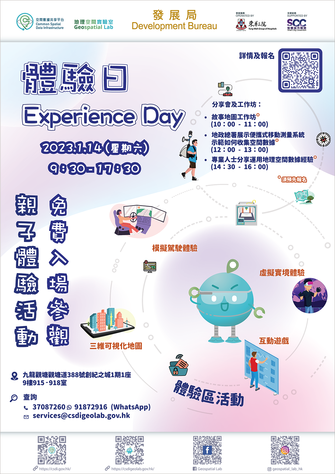
| Date: |
14 January 2023 09:30 - 17:30 |
| Venue: |
Geospatial Lab (Units 915-918, 9/F, Tower 1, Millennium City 1, 388 Kwun Tong Road, Kwun Tong, Kowloon) |
Different interactive games and showcases will be available throughout the day (no reservation required, welcome to visit):
- Driving experience simulator
《Rev to Vertex》- An RPG story-driven car simulator set in the unexplored hills and streets of Hong Kong. - Virtual reality experience zone
- 3D Visualisation Map
- Other games related to spatial data
Reservations are required for the following activities
STEM Parent-child Workshop - Create an Interactive Web Mapping Application
The participants learn to create a local tour by using an interactive web map. Parents can also join the class and learn together with their children.
- Understand what is spatial data
- Learn how to use an interactive web mapping application for creating a tour map
- Enhance their IT and mapping skills to stimulate and cultivate students' creativity
---------------------------------
Time: 10:00 - 11:00
Quota: 15 groups
Intended Audience: P.5 to S.2 students (parents are welcome to join)
Language: Cantonese, supplemented by Chinese teaching materials
Talk and demonstration by the Lands Department showing how to collect spatial data by using 3D Mobile Mapping System
Lands Department demonstrates the use of portable and backpack mobile mapping systems for collecting 3D spatial data. The participants are also given the chance to gain first-hand experience in operating these mapping systems.
---------------------------------
Time: 12:00 - 13:00
Quota: 30
Language: Cantonese, supplemented by English materials
Career Talk (Sharing by professionals of different disciplines on how they use spatial data in their works)
- Sr Yvonne Cheu, Executive Director, Innovation Solutions, Hong Kong, AECOM
- Share how she adopts spatial data and GIS for environmental monitoring and assessment as a land surveyor.
- Share how she adopts spatial data and GIS for environmental monitoring and assessment as a land surveyor.
- Dr CT Low, Geospatial Risk Lead, CWR
- Share how GIS and mapping can help to better understand the spatial distribution of water and climate problems.
- Mr Alex I K Chan, Assistant Mobility Innovation Manager, Bravo Transport Holdings Limited
- Focus on how to adopt GIS and technology in bus operations, passengers information & mobile app, as well as driving safety.
A Q&A session will be held after the sharing session
---------------------------------
Time: 14:30 - 16:00
Quota: 30
Language: Cantonese
Enquiries
Please contact the Geospatial Lab via 3708 7260, WhatsApp 9187 2916 or email services@csdigeolab.gov.hk


