The Government of the Hong Kong Special Administrative Region
Development Bureau
Event Code: E250517
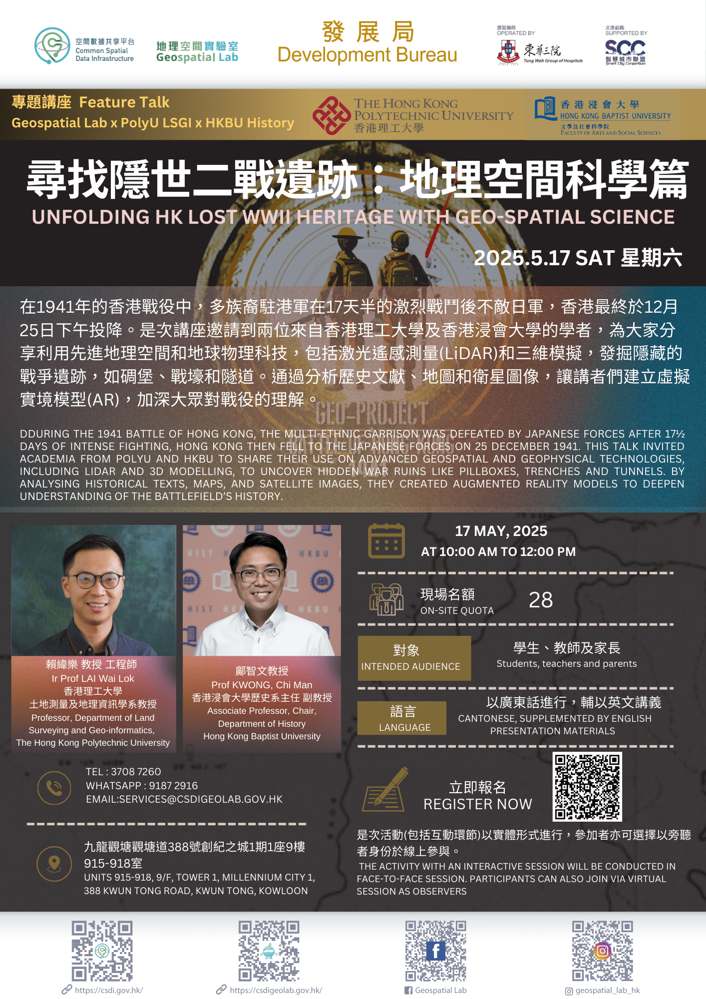
During the Pacific War of 1941-1945, Hong Kong was one of the first places attacked by Japanese forces. The Battle of Hong Kong, which lasted 17 ½ days between 8 and 25 December 1941, witnessed heavy fighting and widespread destruction. The territory’s multi-ethnic garrison fought fiercely against the larger and better-equipped Japanese forces. However, Hong Kong fell to the Japanese forces on 25 December 1941.
Prof Wallace Lai from PolyU and Prof Chi Man Kwong from Baptist University investigate how much is known about the ruins of war and the numerous stories that are hidden in the forests and buried beneath the ground in Hong Kong’s countryside, such as pillboxes, trenches and tunnels. They have used innovative geospatial and geophysical technologies to unfold the long-lost heritage of the Battle of Hong Kong to further archaeological and historical studies of the battlefields 80 years ago. Both academia developed a geo-spatial and technology-based approach to facilitate historical interpretation of the war. It helps expand and deepen the understanding of the British and Japanese military works on the hills. They first studied historical texts, old maps, aerial photos, plans of attack and defence, and satellite images to narrow down the scope of the search. They then developed geo-referenced digital terrain models by adopting 3D point clouds extracted from the Hong Kong Government’s helicopter LiDAR or their own drone LiDAR. The output allowed them to visit and identify those features of war and scan them with a 3D laser to generate a real 3D augmented reality of the battlefield in 1941, so these stories can be geo-connected and told.
Project Link: www.geo-project1941.com
1. Feature Talk – Unfolding HK Lost WWII Heritage with Geo-spatial Science
2. Tour in Geospatial Lab, with showcases and demonstrations (Face-to-face session only)
| Event Code: |
E250517 |
| Date: |
17 May 2025 at 10:00 – 12:00 |
| Venue: |
Geospatial Lab (Units 915-918, 9/F, Tower 1, Millennium City 1, 388 Kwun Tong Road, Kwun Tong, Kowloon) or online |
| Guest Lecturers: |
|
| Language: |
Cantonese, supplemented by English presentation materials |
*Geospatial Lab reserves the right to cancel or reschedule the activity
Ir Prof LAI Wai Lok, Wallace
Ir Prof Wallace Lai is the Professor in the Department of Land Surveying and Geo-Informatics of the Hong Kong Polytechnic University.
He teaches and conducts research and consultancy of nondestructive testing, survey and evaluation to investigate unseen underground utility and engineering structures with ground penetrating radar, infrared thermography and acoustic methods. He also designs, builds and operates the first underground utility survey lab in Hong Kong in 2014.
Prof Lai was commissioned in 2019 to design and build a full-scale 25,000 sq.ft. training and research centre (Q-Leak) of underground leak detection and diagnosis. In the utility lab and Q-Leak, he designs blind test and measures cognitive biases in the process of human-machine interaction.
Recent interest of Prof Lai extends to unfold and model the terrain of hidden and lost WWII heritage sites using a range of geo-spatial technologies including air-borne, terrestrial LiDAR and photogrammetry.
Prof Kwong Chi Man
Prof Kwong Chi Man is an expert on Hong Kong and Asian military history and an Associate Professor at the Department of History at Hong Kong Baptist University, with a PhD from the University of Cambridge's Faculty of Asian and Middle Eastern Studies.
Backed by historical records in Australia, China, Japan, United States, and the United Kingdom, Prof Kwong's studies tell the story of Hong Kong's changing strategic role in the nineteenth and twentieth centuries as well as the people's experience.
Prof Kwong's conservation activities, with an emphasis on high culture, range from academic seminars, government projects, to digital interactive maps for creative commons. In order to maximize the research's impacts, he is also open to popular culture and industrial collaboration including but not limited to tourism, gaming and films.
Please contact the Geospatial Lab via 3708 7260, WhatsApp 9187 2916 or email services@csdigeolab.gov.hk
Contact Info
Telephone: 3708 7260
WhatsApp : 9187 2916
Email: services@csdigeolab.gov.hk
Address
Opening Hours
Monday to Saturday
09:30 am - 1:00 pm
2:15 pm - 5:30 pm
Closed on Sundays and Public Holidays
Follow Us

Links
