Poster of Professional Geospatial Talk - GIS in 3D Urban Modelling using CityEngine

Professional Geospatial Talk

"GIS in 3D Urban Modelling using CityEngine"

Details

Objective

Introduce the concepts of 3D city modelling (including BIM and CIM) and use CityEngine tool to demonstrate

Intended Audience

Parties and individuals interested in spatial data

Activities

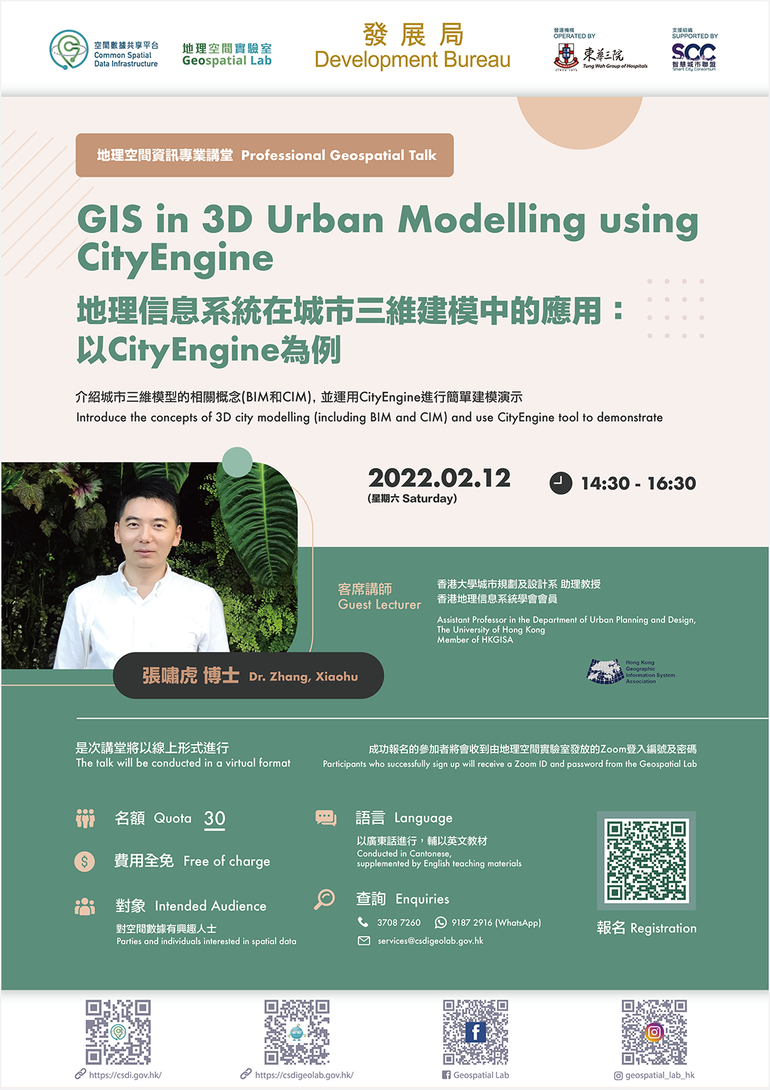
 1. Professional Geospatial Talk – “GIS in 3D Urban Modelling using CityEngine”

2. Q&A session

Date:

12 February 2022 at 14:30 – 16:30

Venue:

Online

Guest Lecturer: Dr. Zhang, Xiaohu, Assistant Professor in the Department of Urban Planning and Design, The University of Hong Kong; Member of HKGISA


(Please refer to “Introduction of Guest Lecturer” for details)

Language:

Cantonese, supplemented by English teaching materials

Registration Details

  • Please register via the registration link

  • Quota: 30 (first-come-first-served)

  • Free of charge

  • Participants who successfully sign up will receive a Zoom ID and password from Geospatial Lab


*Geospatial Lab reserves the right to cancel or reschedule the activity

Introduction of Guest Lecturer

Dr. Zhang, Xiaohu

Xiaohu Zhang is an Assistant Professor in the Department of Urban Planning and Design. Prior to this, he worked in Singapore-MIT Alliance for Research and Technology, MIT Senseable City Laboratory and Sun Yat-Sen University. His scholarship bridges the information gap in sustainable urban and transportation policy-making with stochastic simulation and big data analytics. Broadly interested in urban data science, his recent work explores the sustainability of new shared mobility services, such as scooter sharing, carsharing and ridesharing. His research uses multi-source datasets to advance understanding of pressing urban and transportation issues, e.g., urban expansion, emerging mobility services and the interactions between land use and transportation. His research enriches public policy debates in urban and transportation issues with accurate information evidenced by timely datasets. It also provides a base to stimulate discussions among stakeholders. Harnessing digital technology can prevent policymakers from rushing into inappropriate policy-making with obsolete knowledge that is harmful to both public interests and technological advancement. These efforts will utilize new urban data to pave the way for future sustainable cities. His work has been published in top academic journals of GIS, remote sensing, urban planning, and transportation.

Enquiries

Please contact the Geospatial Lab via 3708 7260, WhatsApp 9187 2916 or email services@csdigeolab.gov.hk